Locale Localization position
Working on a very old bug. I’m not sure if someone noticed it, at least nobody reported it. The coordinate to pixel conversation was not very precise because it used a average resolution for every tile. This works well for higher zoom levels where the resolution does not change much inside a tile. But for lower zoom levels, especially the whole world picture this is certainly not right any easily visible when using way points. See for example Mapparium 0.6 on the right side of the image, all way points are (and tracks) are shifted to north. The solution was not very difficult but needed some thinking, basically a rounding error and precision problem.
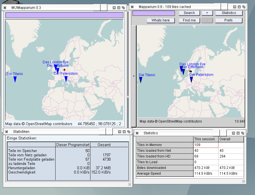
MUIMapparium (Left) and Mapparium (right) Waypoint position comparison and german locale
I also start to play with localization. I never did that before, especially not in FreePascal but it’s not very complicated, just diligent work to replace all strings. So next version will also be available in german (and maybe later some more languages, at least I got an offer for french localization). There is one small problem with that, there is no locale library unit in FreePascal for AmigaOS4 so either I make some defines to turn it off for OS4 or implement the library unit.
Schreibe einen Kommentar