Mapparium
OpenStreetMap viewer for Amiga-Systems. The map can be moved around an zoom. It is possible to set waypoints, or load recorded tracks or waypoints from GPX, TCX, KML or KMZ files. The speed or height curve can be showed and inspected.
Downloads
Please use MUIMapparium due its more recent and more powerful.
MUIMapparium, the next Generation
There is a new implementation of Mapparium in pure MIU/Zune code which makes the whole program much faster especially on 68k Amiga. It still needs an RTG card but a non_FPU version is included, but if it is too slow (especially with tracks and routes showing do not blame me, buy a FPU) On the long run MUIMapparium will replace the Mapparium, at the moment it does not have the same features (but rather close)
Downloads: MUIMapparium
MUIMapparium has it’s own page: MUIMapparium Page
Mapparium 0.5 on MorphOS
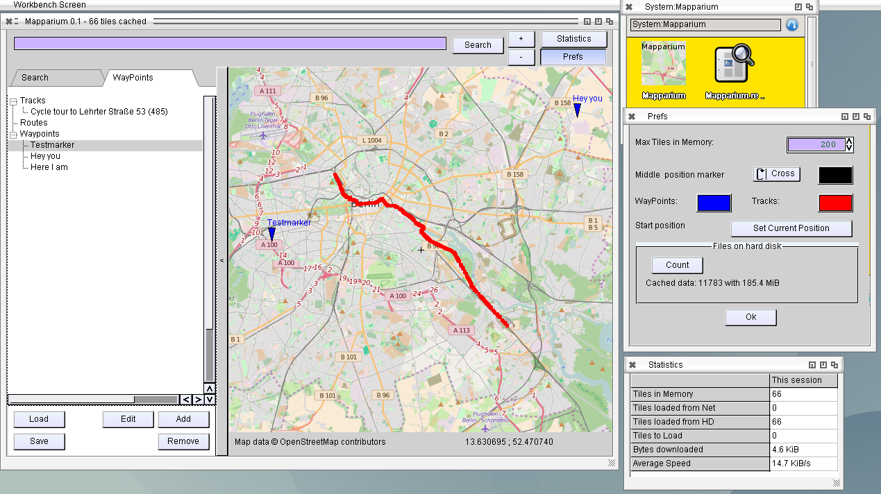
To move the map, click and hold the left mouse button inside the map. Zoom can
be changed with mouse wheel (Zoom in = mouse wheel up), +/- buttons or double
click into the map.
To search for a position on the map type in keywords into the search bar on the
top of the window and press „Search“ the sidepanel will open automatically.
The side panel can be also open or closed by clicking on the panel opener on
the left side next to the map. In the side panel you can find the search
results, tracks and waypoints. Double click to a search result, a track,
a route or a waypoint centers the map onto this feature.
A Double click onto the lower panel copies the middle coord to clipboard using
geo syntax.
To jump directly to a position type in the two coordnates separated by space
„Lat Lon“, or via geo: URI: „geo:lat,lo>?z=ZoomLevel“
To search for a location of an IP-address type ip:
ip:8.8.8.8
To add a new Waypoint select in the sidepanel the a waypoint entry (or the
„waypoint title“) and press „Add“. A waypoint is created at the current
position.
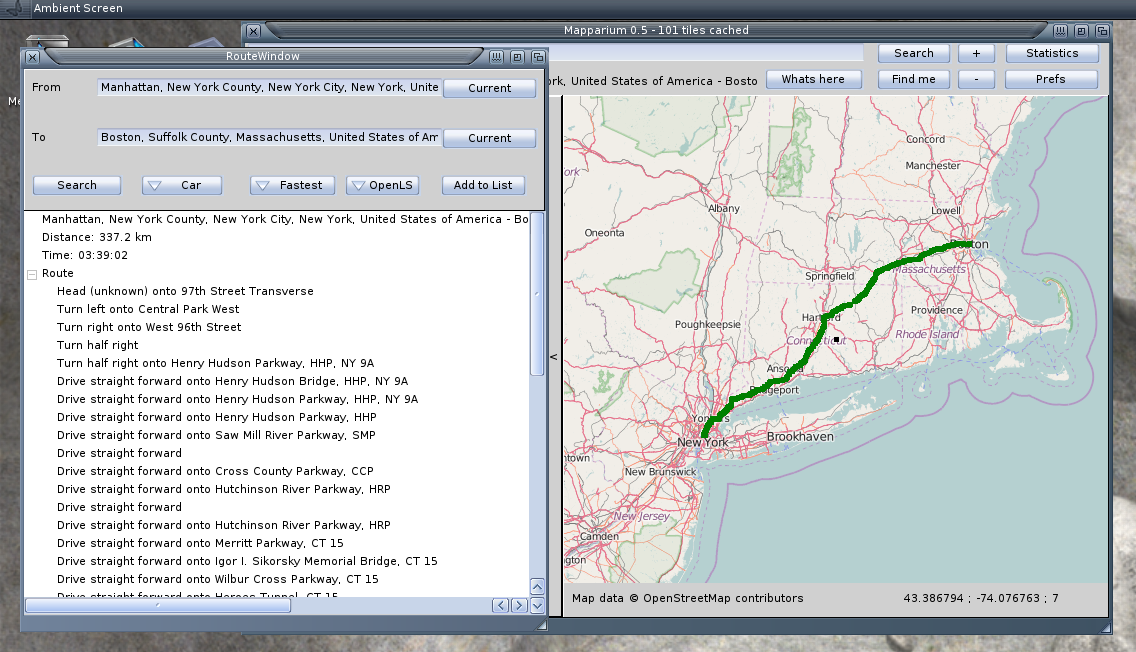
To create a new route select the „Routes“ entry and press „Add“ a new Window
will appear to define the start and end point. You can either use the current
position in the map window or use the two edits to search for your
destinations. Do not forget to press enter when you typed in a new start or
end and select the right address (double click) in the view underneath.
Choose route type (car, bicycle or foot) and if it should be the fastest
or shortest way. You also have to choose which service you want to use.
YOUR is more reliable but supports no informations where the order takes
place, OpenLS is sometimes rather slow, but makes better directions.
A double click on one of the orders zoom to this specific area (not available
for YOUR). To copy the orders to clipboard active the view and press Ctrl+C.
Mapparium on AROS
History
0.6
- ADD: Image List with EXIF position Data
- ADD: Image preview
- ADD: AREXX commands for Add images to imagelist
- ADD: Menu for Main window and ImageList
- ADD: Active Route color
- ADD: Overall statistics
- FIX: Color settings
0.5
- FIX: AROS invisible search text
- ADD: Routing calculation via YOUR or OpenLS
- FIX: better Prefs window
- ADD: Save/load routes from GPX
- CHG: Open TrackView or RouteView on Show/Edit Button
- CHG: Moved Track title edit into TrackView
- ADD: Context sensitive Add Button
- ADD: Possibility to hide/show tracks/route
- FIX: Faster drawing for 68k Amiga
0.4
- ADD: Clear HD Cache by Button in Prefs to a certain zoom level
- ADD: Find current position (by ip)
- ADD: Search position by ip (type: ip:x.x.x.x to search)
- ADD: Get address for current position
- ADD: Zoom in by double mouse click
- ADD: AREXX port with commands „goto“ and „addwaypoint“
- ADD: Loading of Garmin FIT data
- ADD: Other color for active track
- FIX: Umlauts fix in search header
- FIX: Search by Return press in search box
0.3
- FIX: Invisible texts on OS4
- FIX: Go offline if internet is down
- FIX: Start folder for load/save dialogs
- FIX: Filter for dialogs
- FIX: Version informations
- ADD: Load tracks from Garmin TCX files
- ADD: Set size of middle marker
- ADD: Support for geo: URIs
- ADD: DblClick to lower panel copies middle position to clipboard as geo: URI
0.2
- ADD: Show Height/Speed map of recorded tracks
- ADD: Marked position in curve mark also on the map
- ADD: Support for KML/KMZ Loading
- FIX: Optimized image keeping
0.1
- NEW: Initial Release
- ADD: Load OpenStreetMap tiles
- ADD: Load and Save Waypoints and tracks from GPX Files
- ADD: Show WayPoints and Tracks on Map
- ADD: Search on the maps
May I ask why AOS4 version was removed? 🙁
hello fantastic sofware ! could you make an appimage for linux owners ? it would be great to see it under nux even if i own my personnal ares one under icaros 2.1.3
thanx a lot
I have the same question as javierdlr : why is the OS4 version of mapparium removed ? it is the only one that works, MUI mapparium does not work at all.