Uh, there is the way
Implemented GPX reading and writing, really very easy. Tested with some of my cycle routes (I cuted the start away for the screenshot). It also saves the waypoints and tracks into a default.gpx to load at next start, its the easiest way to start. At the moment I draw a little rectangle at every track point and connect them with a line. Sadly it seems to be not possible to draw a thick line with the standard methods, the PenWidth and PenHeight in RastPort are ignored. so I guess this point approach works best for recorded tracks. For planed routes with little points its hard to see. Maybe I write an own line drawing routine, with Bresenham it should be possible to make.
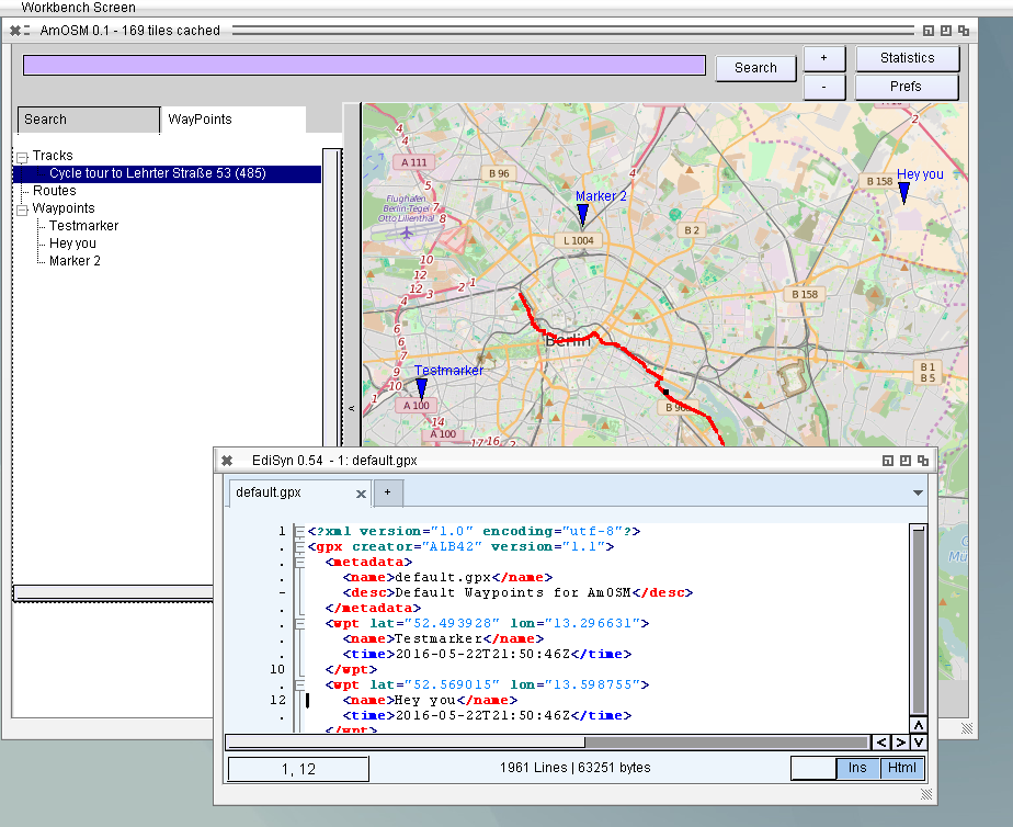
OpenStreetMap with Waypoints and Tracks
Besides I increased the speed dramatically on drawing, on Amiga 68k its much faster now, even usable and resizing on MorphOS with less problems and much faster, it does not recalculate the complete image on every resize step, but only draws the image.
This is amaizing…