Where are others
More work on the OpenStreetMap viewer for Amiga systems. If a Tile is needed it will be set to a Queue and an extra thread checks the Queue tries to load the file from the hard disk, if it does not exist there it loads it from internet. The image shows a special replacement image as long the image is loaded. Of course if you browse around soon the number of tiles become huge. At a time you need to clean the tiles from memory. I introduced a maximum tile number to hold in memory (currently 1000). At every tile the time of last use is noted. The list is sorted and the oldest are removed (oldest means longest time not used).
It works already very nice, I added a little statistic window to see, when tiles are loaded from HD or from Net. Later I will introduce a prefs window to configure the number of tiles to keep in memory especially for Amiga 68k would be important to reduce the value. 1000 tiles needs around 150 MiB. Also the cache on hard disk could be inspected and deleted then. I checked my cache folder, which stores the tile files since I started this work, there are 8400 files inside with a complete size of 150 MB, so its not so urgent to clean it. OpenStreetMap suggests to keep the cache images for at least 7 days or check the status online. I do not plan to edit, so for me it’s not so important to have the very last map updates.
The next step to become more useful I added a search function, already work very nicely, only had some problems with german umlauts (äüö) and other standard characters (é,è,Î and so on). The Input from the Edit needs to be converted to UTF8 using AnsiToUTF8(). Maybe I should do that already indide the LCL code (like I make UTF8ToAnsi when drawing text to screen, thats the reason the copyright sign work).
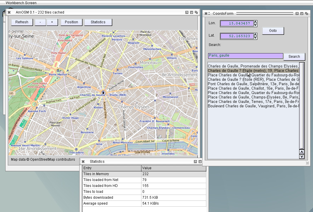
AmOSM with Search function
The further work will include waypoints and tracks/routes with import and export of GPX data, usual format of GPS devices (mine also) and maybe KMZ the Google Earth format. In principle it would be nice to also read GPS data from a real GPS device, which is connected via serial cable with computer. I’m wondering how to use serial connection in AROS, if even possible, maybe even with an USB to serial adapter, most computers does not have serial connectors anymore.
Schreibe einen Kommentar